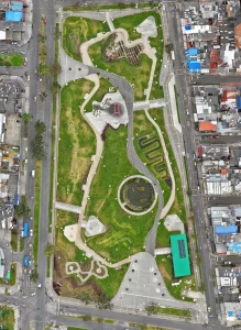
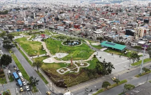
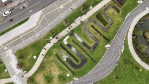
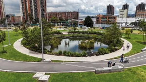
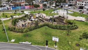
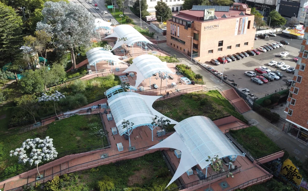
Aguaviva Ecological Park is being developed and managed by Bogotá’s District Institute of Recreation and Sports (IDRD). With an investment of $14.581 billion Colombian pesos, the project benefits more than 330,000 residents of the locality of Puente Aranda. It is being developed within the framework of the city’s new Land Use Plan (POT), which seeks to make Bogotá greener through urban revitalization in industrial areas. The transformation of a former industrial site into Aguaviva Ecological Park posed urban, ecological, and sociocultural challenges—including contaminated soil, suboptimal planting conditions, the reimagining of a “non-place,” and community appropriation. These challenges became opportunities for a design process led by JAM Ingeniería, Estudio Continuo, and TESELA Taller de Paisaje y Urbanismo, with the participation of the Bochica neighborhood community, the Puente Aranda gardeners, and the Local Mayor’s Office.
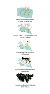
Based on the concept of landscape—understood as the relationship between spatiality, perception, and time—the site was characterized from three perspectives: ecological, through the identification of natural elements and processes; urban, through land use and patterns of occupation; and social, through the communities present and the ways they inhabit the territory. This analysis led to the identification of five historical periods, each defined by the presence of water as a determining element: a) lacustrine (30,000 BCE –1500 BCE); b) amphibian, with Muisca occupation (1500 BCE –1600 CE); c) agricultural-colonial (1600–1950); d) industrial-residential (1950–2022); and e) residential-environmental (2022–present).
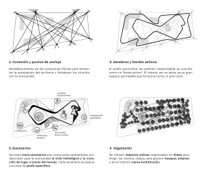
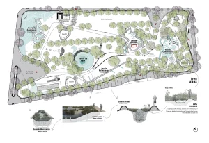
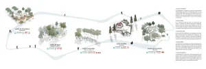
The project’s core strategy, known as “Social Reinterpretation of the Territory,” seeks to promote environmental education and cultural identity through urban and landscape elements that foreground ecological processes—with water as the central focus—while strengthening social cohesion, enjoyment, and a connection to the site’s history. Based on this concept, five settings, or environmental classrooms, were designed to connect historical periods with phases of the water cycle through themed gardens:
These areas are connected by an interpretive trail that facilitates circulation through the park while encouraging visitors to learn about its natural environment. They are complemented by 2,070 m2 of green cover and 148 native trees of varying heights and species, which, together with insect hotels and ecological perches, provide shelter, food, and ecosystem connectivity. Meanwhile, the urban garden strengthens the social fabric, community organization, and collective work. In addition, five types of sustainable urban drainage systems were implemented—bioretention areas, storage tanks, retention ponds, green swales, and infiltration trenches—ensuring zero runoff during peak rainfall events.
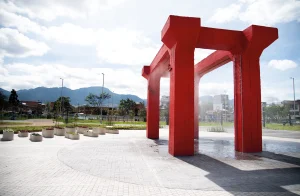
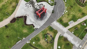
With the aim of softening boundaries, the platforms integrate movement and rest, creating an active edge that connects the urban environment with the park’s inner ecological space. The multipurpose plazas serve as entry points and gathering places. They are connected by a paved path that evokes the area’s industrial past while allowing for activities such as rollerblading and recreational basketball. To diversify community use, the program is being expanded to include areas for low-impact active recreation.
In keeping with the concept, the design preserved the existing asphalt slab as a base for the park and reused more than 8,000 tons of rubble from the demolition of the buildings to shape the terrain and construct the gabions. This approach reduced the project’s carbon footprint and promoted circular economy principles. In line with the principles of eco-urban planning and nature-based solutions, the park has been awarded Bogotá Sustainable Construction Seal and is recognized as the city’s second carbon-neutral park.